PLACES & LANDSCAPES
into the Changing World
Geography 1: Final Requirement
Scroll to explore

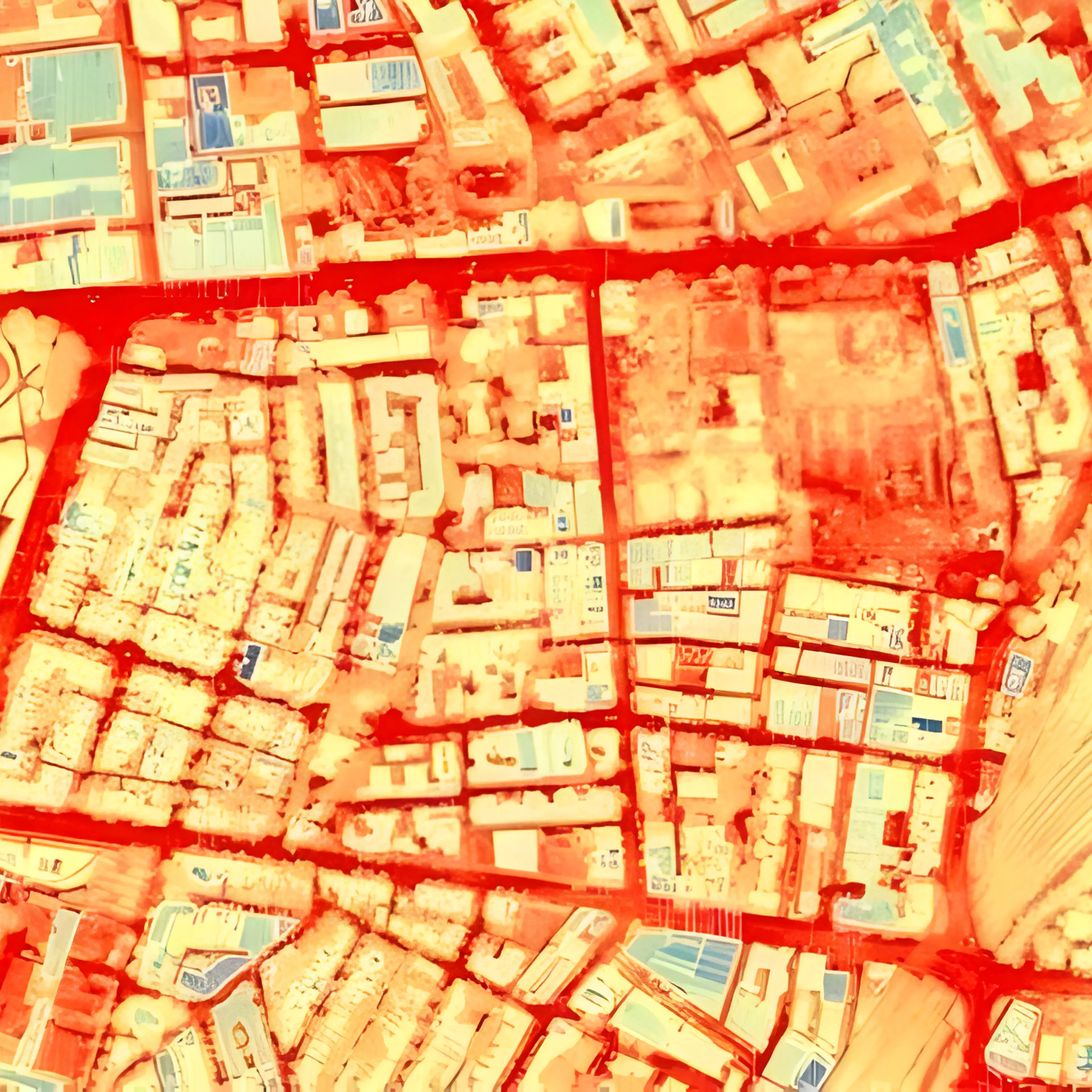
THE MENTAL MAP VS. THE APP
Cognitive Cartography and Spatial Perception
The Epistemological Crisis of Modern Wayfinding
In the contemporary urban experience, the act of navigation has been increasingly offloaded to algorithmic authorities. The reliance on Global Positioning System (GPS) applications such as Google Maps and Waze has altered the relationship between the human subject and the physical terrain.
These tools present space as a Euclidean reality: a continuous, measurable, and objective grid where distance is a function of mathematics and time is a function of traffic algorithms. However, this "cartographic map" often stands in contrast to the "mental map" (or cognitive map), the internal representation of space held within the mind of the individual.
While digital maps provide objective accuracy, the mental map reveals the "emotional geography" of daily life. As geographers argue, the transformation of abstract "space" into meaningful "place" occurs through sustained human interaction.
Lynchian Analysis and the Nature of ExportedImageability
To understand the architecture of the mental map, one must turn to the foundational work of Kevin Lynch. In his text The ExportedImage of the City (1960), Lynch argued that an individual's mental map is constructed through the interaction between the observer and the environment.
He identified five distinct elements that constitute the structural skeleton of a mental map:
Lynch's Five Elements
Paths
The channels along which the observer customarily, occasionally, or potentially moves
Edges
Linear elements not used or considered as paths by the observer
Nodes
Strategic points, the intensive foci to and from which the observer is traveling
Districts
Medium-to-large sections of the city with some common, identifying character
Landmarks
Point references; external to the observer, used in wayfinding
The Algorithm vs. The Sketch
The disparity becomes clear when we imagine and compare a screenshot of a digital route with a hand-drawn sketch. The digital map presents the campus as a seamless continuum. Every building is labeled with equal font size.
Conversely, the hand-drawn map is fragmentary:
Scale Distortion
The dormitory and the "Good Siomai Spot" are drawn disproportionately large, occupying perhaps 40% of the paper surface. This reflects their significance as Nodes of comfort and biological sustenance.
Selective Omission
Meanwhile, vast areas of the campus—administrative buildings or parking lots—are completely absent. This is the "terra incognita" of daily life; the mental map only records what is lived.
Emotional Annotation
Certain Paths may be drawn with jagged lines or darkened pencil strokes, suggesting routes associated with stress (e.g., "The Long Walk to 8 AM Math"). This reveals the "psychogeographic" layer absent from algorithmic representation.
The Subjectivity of the Landscape
The comparison confirms that human perception of space is fundamentally subjective. The digital map is a tool of transit; the mental map is a record of dwelling.
We do not live in a world of meters and minutes, but in a world of anxieties, pleasures, and memories.
THE MICROCLIMATES OF COMMUTING
Anthropogenic Heat and Urban Design
The Atmospheric Transition
The daily commute is often conceptualized as movement through distance, but geographically, it is a movement through distinct atmospheric zones. Within the span of a few meters, a pedestrian can traverse environments that differ radically in temperature and air quality.
We analyze the sensory experience of the "Microclimate," specifically the transition from a vegetated "Green Zone" to a paved "Concrete Zone." This is the localized manifestation of the Urban Heat Island (UHI) effect.
The Observation: A Tale of Two Zones
The Green Zone
Typified by areas like the Academic Oval in UP Diliman, this zone is characterized by mature trees and unsealed soil. As the commuter enters, there is a noticeable drop in thermal stress.
Sensory Characteristics:
- Temperature drop of 3-5°C compared to adjacent concrete areas
- Dappled shade creating cool pockets
- Sensation of moving air (enhanced by transpiration)
- Softer ambient sound (leaves absorb noise)
- Visual relief from harsh glare
The Concrete Zone
Typified by open parking lots or highways. Stepping into this zone feels like walking into a wall of heat. The heat is omnidirectional—beating down from the sun and radiating up from the pavement.
Sensory Characteristics:
- Surface temperature of asphalt: 50-60°C on sunny days
- Harsh, unfiltered sunlight causing squinting
- Stagnant, heavy air with no breeze
- Heat shimmer rising from pavement
- Amplified traffic noise from hard surfaces
The Physics of Urban Heat
The difference between these zones is a function of physics and urban design, specifically Albedo and Evapotranspiration.
The Albedo Effect
Albedo is the measure of surface reflectivity—the percentage of solar radiation that bounces back into space rather than being absorbed. It ranges from 0 (perfect absorption) to 1 (perfect reflection).
Low Albedo (Concrete/Asphalt)
Albedo: 0.05 - 0.20
Acts as "black body" absorbing 80-95% of solar radiation, converting it to sensible heat and re-radiating throughout the day and night.
Higher Albedo (Vegetation)
Albedo: 0.15 - 0.25
Reflects more light and scatters solar energy. The irregular surface of leaves creates diffuse reflection rather than direct absorption.
Evapotranspiration
The most critical differentiator is water. This is where the Green Zone achieves its true cooling power.
In the Green Zone:
Trees engage in evapotranspiration, the process of absorbing water from the soil through roots and releasing it as vapor through stomata (leaf pores). This phase change from liquid to gas consumes enormous amounts of solar energy as latent heat flux (energy used for evaporation) rather than sensible heat flux (energy that heats the air). A single mature tree can transpire 100+ gallons of water per day, functioning as a biological air conditioner.
In the Concrete Zone:
Surfaces are impermeable. Rainwater runs off into drains rather than being stored in soil. Without moisture to evaporate, 100% of the absorbed solar energy is converted to sensible heat, directly heating the air and "cooking" the pedestrian. The surface remains dry and hot, with no cooling mechanism.
The Politics of Shade
The microclimate of the commute reveals that thermal comfort is a product of planning decisions. The "Concrete Zone" represents a landscape designed for the machine (impermeable, durable, efficient for vehicles) at the expense of the human organism.
The tree is infrastructure. The differential experience of these microclimates demonstrates that geography is constructed through choices about materials, vegetation, and water management.
Thermal comfort is a product of planning; the Concrete Zone is a landscape designed for the machine at the expense of the human organism.

THE GEOGRAPHY OF BREAKFAST
Global Supply Chains and Food Miles
The Plate as a Map of the World
A seemingly simple breakfast (corned beef, garlic rice, and coffee) appears to be a locally rooted meal. However, a geographic dissection reveals it is an assembly of commodities, each ingredient tracing across oceans and continents.
This meal serves as an entry point into the study of Global Supply Chains and the concept of "Food Miles," revealing the geography embedded in the act of eating.
Tracing the Origins: A Spatial Analysis
The Corned Beef
While the brand may be local (e.g., Purefoods, Argentina), the meat often isn't. The Philippines imports vast quantities of "carabeef" (water buffalo meat) from India due to lower production costs and trade agreements.
Origin: Livestock farms in Maharashtra or Uttar Pradesh, India
Processing: Slaughterhouses and canning facilities in Mumbai or Chennai
Transport: Shipped via bulk cargo carriers to Manila Port
Estimated Distance: ~4,800 km
The Rice
Despite the Philippines being an agricultural archipelago with a historical rice culture, domestic production often cannot meet demand. Much of the rice consumed likely originated in the Mekong Delta of Vietnam or Thailand.
Origin: Paddy fields in the Mekong Delta, Vietnam
Processing: Milling facilities near Ho Chi Minh City or Can Tho
Transport: Bulk carriers to Manila, then trucks to local markets
Estimated Distance: ~1,700 km
The Coffee
If consuming an instant "3-in-1" mix (a staple in Filipino households), the Robusta coffee beans likely traveled from Vietnam or Indonesia, were processed in a regional manufacturing hub, and then repackaged locally with sugar and creamer.
Coffee Beans: Robusta plantations in Central Highlands, Vietnam
Sugar: Possibly from Thailand or Brazil sugarcane plantations
Creamer: Palm oil from Malaysia/Indonesia + dairy powder from New Zealand
Processing: Regional facility in Singapore or Manila
Estimated Distance: ~1,200+ km (beans alone)
Globalization and Logistics
This breakfast demonstrates the efficiency (and paradoxes) of Globalization. International trade agreements, containerization, and economies of scale allow food to be transported across oceans at a fraction of the cost of local production.
The Paradox
It creates an economic anomaly where meat shipped 4,800 km from India is cheaper than beef raised in a neighboring province. This is not due to quality, but to:
- Economies of scale in industrial agriculture
- Lower labor costs in exporting countries
- Efficiency of bulk maritime shipping
- Trade agreements reducing tariffs
Food Miles Calculation
The concept of "Food Miles" measures the total distance food travels from production to consumption. This seemingly local breakfast:
~6,000+ km
Total Food Miles per Single Meal
(4,800 km beef + 1,700 km rice + 1,200 km coffee beans + processing/distribution)
The Hidden Geography
This highlights the "invisible geography" of consumption. Every bite connects the student to:
- The water politics and dam systems of the Mekong River
- The livestock regulations and religious export laws of India
- The labor conditions of Vietnamese coffee harvesters
- The carbon footprint of transoceanic shipping routes

"THIRD PLACES" AND STUDENT CULTURE
The Sociological Necessity of Place
The Sociological Necessity of Place
In the structured life of a student, space is rigorously categorized into the First Place (home/dormitory) and the Second Place (classroom/workplace). However, for a community to thrive, socially, emotionally, and culturally, it requires a "Third Place."
This concept, defined by sociologist Ray Oldenburg in his work The Great Good Place (1989), describes settings for informal public life that exist outside the home and work. For the university student, spaces like the Sunken Garden serve this critical function.
1st Place
Home / Dormitory
Private, personal, family space where one resides
Intimate, secure
2nd Place
Work / School
Structured, hierarchical, productive environment
Formal, goal-oriented
3rd Place
Community Space
Neutral, inclusive, social gathering point
Voluntary, egalitarian
Description and Cultural Analysis
The Sunken Garden is a physical depression in the landscape that acts as a natural amphitheater. Its "sunken" nature provides acoustic and visual separation from street noise while maintaining connectivity to surrounding spaces.
Oldenburg identified eight key characteristics that define a Third Place:
On Neutral Ground
Occupants are not legally or financially tied to the area. There is no host-guest relationship; everyone has equal claim to occupy the space. No one is required to play host, and all feel at home and comfortable.
The Leveler (Inclusive)
Third Places put no importance on an individual's status in society. Economic and social statuses are rendered irrelevant. In the classroom, hierarchies exist (Professor vs. Student); in the Sunken Garden, these dissolve.
Conversation is the Main Activity
The primary activity in Third Places is conversation, which is lively and engaging. Nothing is more important than good conversation and sociability—not consumption, productivity, or structured activity.
Accessibility and Accommodation
Third Places must be easy to access and accommodate people's needs. They must be open during times when people are available (early morning, late evening, weekends). The Sunken Garden is always accessible.
The Regulars
The space has a core group of regular occupants who give the place its character and help set the welcoming mood. These regulars attract newcomers and make them feel comfortable, ensuring the space maintains its social vitality.
A Low Profile
Third Places are characteristically plain and unpretentious. They are homely and without formal claims. This lack of ostentation puts people at ease—there is no pressure to dress up or perform status.
The Mood is Playful
The tone of conversation is never marked by tension or hostility. Instead, it is playful and witty. Clever wordplay, teasing, and humor are common. This levity differentiates it from the serious atmospheres of work and home responsibilities.
A Home Away from Home
Occupants experience the space as both physically and psychologically comfortable. It provides a sense of possession and belonging that mirrors the feeling of being home, creating rootedness in the community.
The Sunken Garden as Third Place
The lack of walls or gates makes the space highly permeable, it invites "loitering" not as a negative act of vagrancy, but as a productive social act of community building. Students gather without agenda, forming spontaneous social bonds that constitute the "social capital" of university life.
Conclusion
This validates the importance of unstructured, non-commercial, and non-institutional space in urban planning. We live in an era where public space is increasingly privatized or securitized (malls require purchase, parks have curfews), the Third Place remains a radical spatial anomaly, a space of genuine publicness where the "emotional geography" of the student experience finds its most communal expression.

THE PULSE OF THE POPULATION
Spatiotemporal Dynamics and Urban Rhythms
Time as a Geographic Dimension
Geography is traditionally concerned with where things happen. However, a complete spatial understanding requires analyzing when things happen.
In the context of UP Diliman, the campus is not a static container for activity. Rather, it is a fluid system where population density ebbs and flows like a tide. The same corridor that is packed at 7:30 AM is a ghost town by 9:00 PM. We employ Time Geography, a theoretical framework developed by Swedish geographer Torsten Hägerstrand, to analyze the "pulse" of the campus.
The Space-Time Prism
Hägerstrand introduced the concept of the Space-Time Path—a trajectory representing an individual's movement through both space and time. Every human action occupies both a location (where) and a duration (when).
He argued that human movement is not free but governed by three types of constraints that form a "Space-Time Prism," the cone of possible locations a person can reach within a given timeframe:
Capability Constraints
Biological and physical limits on human action. Humans must eat, sleep, and rest. Travel speed is limited by available transportation.
EXAMPLES:
• A student cannot attend a 6:00 AM class if they require 4 hours of sleep and went to bed at 3:00 AM
• Walking speed limits how far one can travel in 10 minutes between classes
• The need to eat lunch constrains midday scheduling
Coupling Constraints
The requirement to be at a specific place at a specific time with other people. This is the fundamental mechanism of social coordination.
EXAMPLES:
• A 7:00 AM class lecture requires student and professor to couple in space-time
• Group project meetings require all members to synchronize their paths
• Exam schedules create massive temporal bundles of converging paths
Authority Constraints
Institutional or legal rules that control access to space and time. These are socially constructed boundaries.
EXAMPLES:
• Building curfews and lockdowns that prevent access after certain hours
• ID requirements restricting entry to specific facilities
• Class schedules that dictate when spaces are accessible vs. off-limits
The Space-Time Prism: These three constraints together define the limits of where a student can possibly go within a given timeframe. If a student has class at 9:00 AM and must travel 15 minutes to get there, their Space-Time Prism narrows, that is, they cannot be more than 15 minutes away at 8:45 AM. The "prism" visualizes this cone of accessibility.
The Campus Heartbeat
The campus functions like a biological organ with systolic and diastolic phases—periods of maximum contraction (peak density) and expansion (dispersal).
07:30 — THE SYSTOLE (PEAK)
POPULATION DENSITY
Corridor becomes a massive "bundle" of converging Space-Time Paths. Students rush from dormitories, jeepney stops, and parking lots toward classroom buildings.
MOVEMENT BEHAVIOR
Movement is directed, urgent, and synchronized. Everyone walks with purpose. There is little lingering or social interaction, the Coupling Constraint (7:00 AM class start) creates temporal pressure.
SPATIAL FUNCTION
The corridor functions strictly as a channel for transit, a "Path" in Lynchian terms. It is not a place to dwell.
DOMINANT CONSTRAINT
Coupling Constraint (must reach classroom on time)
21:00 — THE DIASTOLE (LULL)
POPULATION DENSITY
The same corridor is nearly empty. Only scattered individuals or small groups remain, night students, security guards, joggers, or visitors using the space for leisure.
MOVEMENT BEHAVIOR
Movement is leisurely, exploratory, social. Groups linger and chat. The urgency has evaporated.
SPATIAL FUNCTION
The corridor transforms into a container for social and recreational activity. It becomes a de facto "Third Place."
DOMINANT CONSTRAINT
Authority Constraint (building access hours, curfews)
5.4 Conclusion: The Fluidity of Geography
This demonstrates that population is a dynamic, rhythmic phenomenon. A "high-traffic area" is only high-traffic for specific temporal windows. The function and character of space change with the temporal pulse of institutional schedules.
The student's daily life is a constant negotiation of the Space-Time Prism, attempting to fit necessary biological activities (eating, sleeping), social desires (meeting friends), and institutional obligations (attending class) within the rigid temporal walls erected by the university schedule.
Geography, therefore, is about the "when." Place is a product of temporal and functional patterns. The campus pulses with rhythms dictated by institutional, biological, and social forces, revealing that human geography is ultimately a study of coordinated time.